Maritime Museum (Galle): photo 12
Photo 12 of 63 in Gallery: Maritime Museum (Galle)
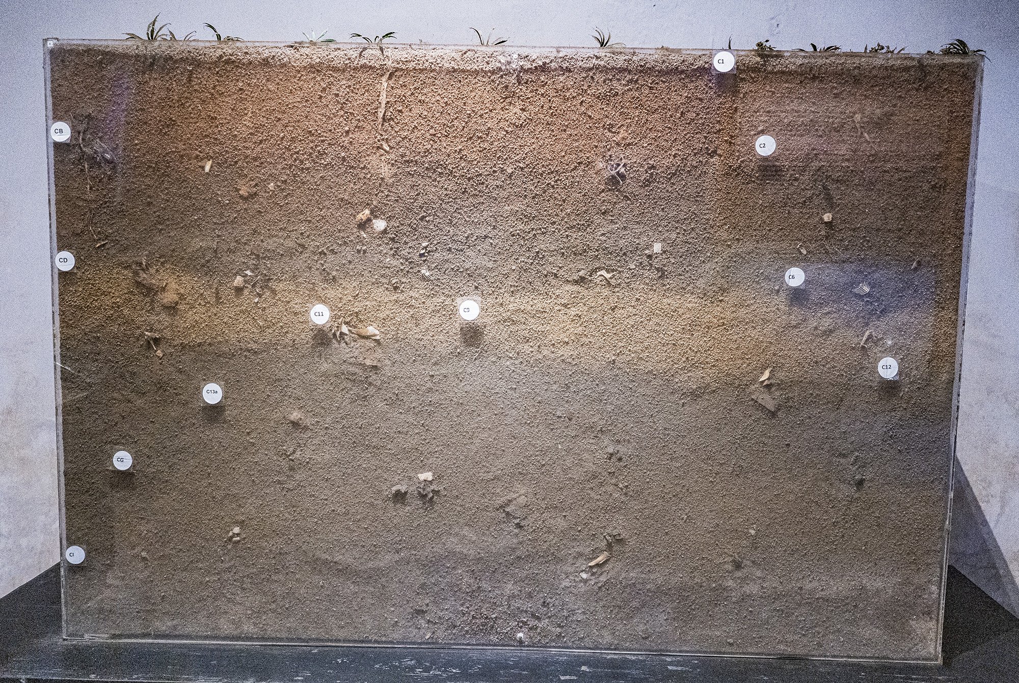
Image title: Kirinda Profile
Description of the photo
English text:
Kirinda Profile — This is the vertical stratigraphy of excavations in an old settlement mound in Kirinda. The Layers of soil displayed here have revealed the remains of fish that were hunted, apart from the artefacts recovered from within. These demonstrate one aspect of the relationship between man and the sea during the historical period. The Layers of the lower levels in Kirinda have been dated to 450 BCE.
Sinhala text (not proofread):
කිරින්ද පස් පැති කඩ — මෙහි දැක්වෙන්නේ කිරින්දේ මුහුදු නගරයේ වූ පැරණි ජනාවාස ගොඩැල්ලක සිදු කරන ලද කැණිමක සිරස් ස්ථර වින්යාස යයි. මෙහි දැක්වෙන පස් ස්ථර වලින් පුරා වස්තු වලට අමතරව එක් එක් කාලවල දඩයම් කළ මාළුන්ගේ ඇටකටු ද හමු වී තිබේ. මේ සාධක ඓතිහාසික යුගයේදී මිනිසා මුහුද සමඟ දැක්වූ සබඳතාවයන්හි එක් මුහුණුවරක් නිරූපණය කරයි. කිරින්දේ පහළ පස් ස්ථර ක්රිස්තු පූර්ව 450ට දින නිර්ණය කොට තිබේ.
Transcription:
kirinda pas pæti kaḍa — mehi dækvennē kirindē muhudu nagarayē vū pæraṇi janāvāsa goḍællaka sidu karana lada kæṇimaka siras sthara vinyāsa yayi. mehi dækvena pas sthara valin purā vastu valaṭa amatarava ek ek kālavala daḍayam kaḷa māḷungē æṭakaṭu da hamu vī tibē. mē sādhaka aitihāsika yugayēdī minisā muhuda samaṅga dækvū sabandatāvayanhi ek muhuṇuvarak nirūpaṇaya karayi. kirindē pahaḷa pas sthara kristu pūrva 450ṭa dina nirṇaya koṭa tibē.
Automated translation (not verified):
Kirinda five-sided section — This shows the vertical layered configuration of an excavation of an ancient settlement mound in the coastal city of Kirinda. In addition to artifacts, the bones of fishes hunted in each period have been found in the soil layers shown here. These factors represent one facet of the relationship between man and the sea in historical times. The bottom five layers of Kirinda have been dated to 450 BC.
Tamil text (not proofread):
கிரிந்த வடிவ உருவம் — கிரிந்த கடல் நகரத்தில் உள்ள ஓர் பழைய குடியிருப்பில் செய்யப்பட்ட அகழ்வாராய்வின் போது மேலிருந்து கீழ் வரை மண் அடுக்குகளின் வரிசையான உருவம் கண்டுபிடிக்கப்பட்டது.இதில் உள்ள மண் அடுக்கினுள் தொல்பொருருட்களுக்கு தொல்பொருட்களுக்கு மேலதிகமாக ஒவ்வொரு காலகட்டங்களில் வேட்டையாடப்பட்ட மீன்களின் எச்சங்கள் கூட கண்டு பிடிக்கப்பட்டன. இந்த ஆதாரங்கள் வரலாற்று யுகத்தில் மனிதர்களால் சமுத்திரத்துடன் பேணி வந்த தொடர்பினைப் பற்றிய ஓர் தோற்றத்தை நிரூபிக்கின்றது. கீழ் மண் அடுக்குகள் கி.மு 450க்கு காலம் நிர்ணயிக்கப்பட்டுள்ளது.
Transcription:
kirinta vaṭiva uruvam — kirinta kaṭal nakarattil uḷḷa ōr paḻaiya kuṭiyiruppil ceyyappaṭṭa akaḻvārāyviṉ pōtu mēliruntu kīḻ varai maṇ aṭukkukaḷiṉ varicaiyāṉa uruvam kaṇṭupiṭikkappaṭṭatu.itil uḷḷa maṇ aṭukkiṉuḷ tolporuruṭkaḷukku tolporuṭkaḷukku mēlatikamāka ovvoru kālakaṭṭaṅkaḷil vēṭṭaiyāṭappaṭṭa mīṉkaḷiṉ eccaṅkaḷ kūṭa kaṇṭu piṭikkappaṭṭaṉa. inta ātāraṅkaḷ varalāṟṟu yukattil maṉitarkaḷāl camuttirattuṭaṉ pēṇi vanta toṭarpiṉaip paṟṟiya ōr tōṟṟattai nirūpikkiṉṟatu. kīḻ maṇ aṭukkukaḷ ki.mu 450kku kālam nirṇayikkappaṭṭuḷḷatu.
Transcription:
kirintha vadiva uruvam — kirintha kadal nagarathil ulla or pazhaiya kudiyiruppil seyyappatta agazhvarayvin pothu melirunthu kizh varai man adukkugalin varisaiyana uruvam kandupidikkappattathu.ithil ulla man adukkinul tholporurudkalukku tholporudkalukku melathigamaga ovvoru kalagattangalil vettaiyadappatta minkalin echangal kuda kandu pidikkappattana. intha atharangal varalarru yugathil manitharkalal samuthirathudan peni vantha thodarpinaip parriya or thorrathai nirupikkinrathu. kizh man adukkugal ki.mu 450kku kalam nirnayikkappattullathu.
Automated translation (not verified):
Girinda Shape — Excavations of an old settlement in the sea city of Girinda revealed a series of earthen layers from top to bottom. In addition to the artefacts, the remains of fish hunted from different periods were also found in the earthen layer. These evidences provide a glimpse into the relationship maintained by humans with the ocean throughout the historical period. The lower soil layers have been dated to 450 BC.
Gallery information:
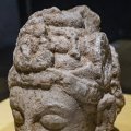
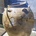
These photos were taken at the Maritime Museum in Galle (Sri Lanka) which include objects recovered from the 2nd century B.C. Godawaya shipwreck. The Maritime Museum is housed in Galle's historic Dutch warehouse (built in 1671) and opened its doors on May 9, 1992. The Maritime Archaeology Museum is serving as a centre of education for various groups of visitors and researchers of Southern region of Sri Lanka.
Photo details:
Date: 2023-09-17
Camera: SONY ILCE-6400
Exposure: 1/60
Aperture: f/4
ISO: 6400
Focal length: 20mm
High resolution:
Download file
Size: 1.72 MB
Resolution: 2000 x 1342
© Copyright: see gallery source