Habarana Tampita Rajamaha Viharaya: photo 7
Photo 7 of 49 in Gallery: Habarana Tampita Rajamaha Viharaya

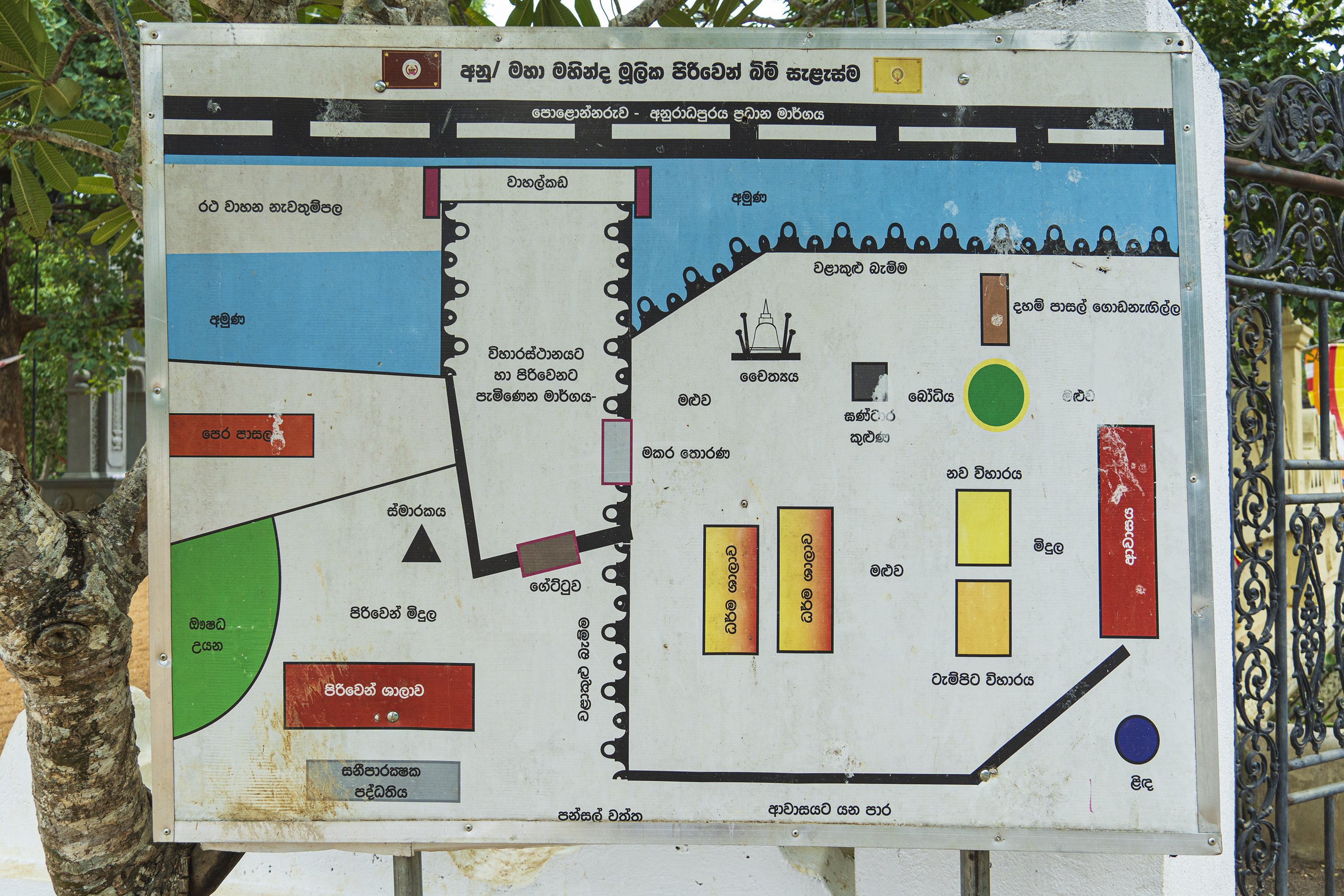
Image title: Temple ground map
Description of the photo
Transcription:
අනු/ මහා මහින්ද මූලික පිරිවෙන් බිම් සැළැස්ම
anu/ mahā mahinda mūlika piriven bim sæḷæsma
anu/ maha mahinda mulika piriven bim salasma
Gallery information:
These photos show the Habarana Tampita Rajamaha Vihara [Viharaya] which is a small Buddhist temple situated in Habarana (Sri Lanka) built during the Kandyan era. Technically, a “Tampita Vihara [Viharaya]” refers to a certain structure built on a wooden platform which itself rests on stones. According to tradition, this temple was built by king Vasabha (65-109 AD) of the Anuradhapura kingdom.
Photo details:
Date: 2023-09-01
Camera: SONY ILCE-6400
Exposure: 1/200
Aperture: f/4.5
ISO: 100
Focal length: 18mm
High resolution:
Download file
Size: 2.87 MB
Resolution: 3000 x 2000
© Photograph by Gabe Hiemstra.
License: CC BY-NC-ND 4.0

