Egypt Through The Stereoscope
A Journey Through The Land Of The Pharaohs
by James Henry Breasted | 1908 | 103,705 words
Examines how stereographs were used as a means of virtual travel. Focuses on James Henry Breasted's "Egypt through the Stereoscope" (1905, 1908). Provides context for resources in the Travelers in the Middle East Archive (TIMEA). Part 3 of a 4 part course called "History through the Stereoscope."...
Maps And Plans
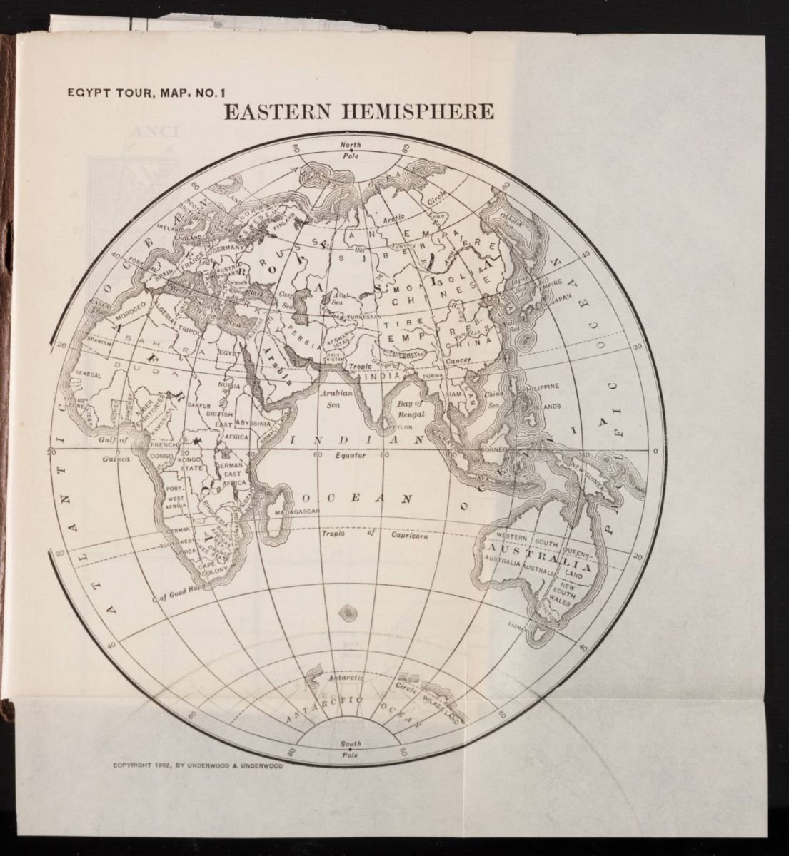
Egypt Tour, Map No. 1: Eastern Hemisphere
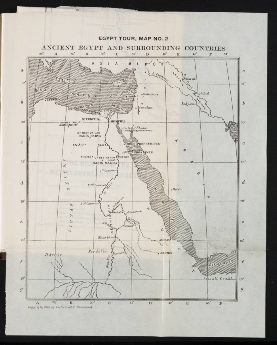
Egypt Tour, Map No. 2: Ancient Egypt and Surrounding Countries
Egypt Tour, Map No. 3: The Nile from the Mediterranean to Khartum

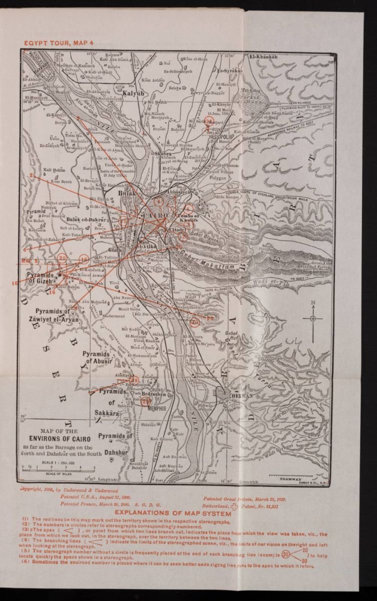
Egypt Tour, Map No. 4: Map of the Environs of Cairo
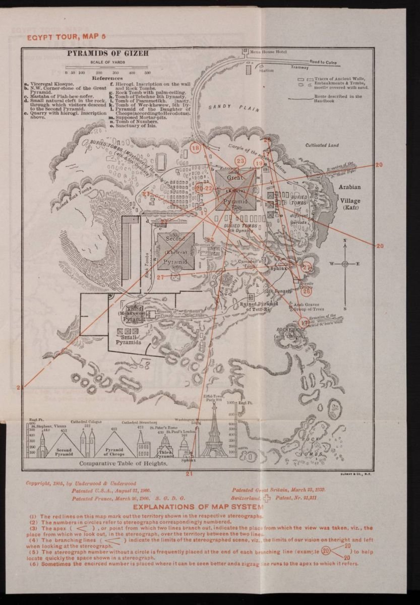
Egypt Tour, Map No. 5: Pyramids of Gizeh
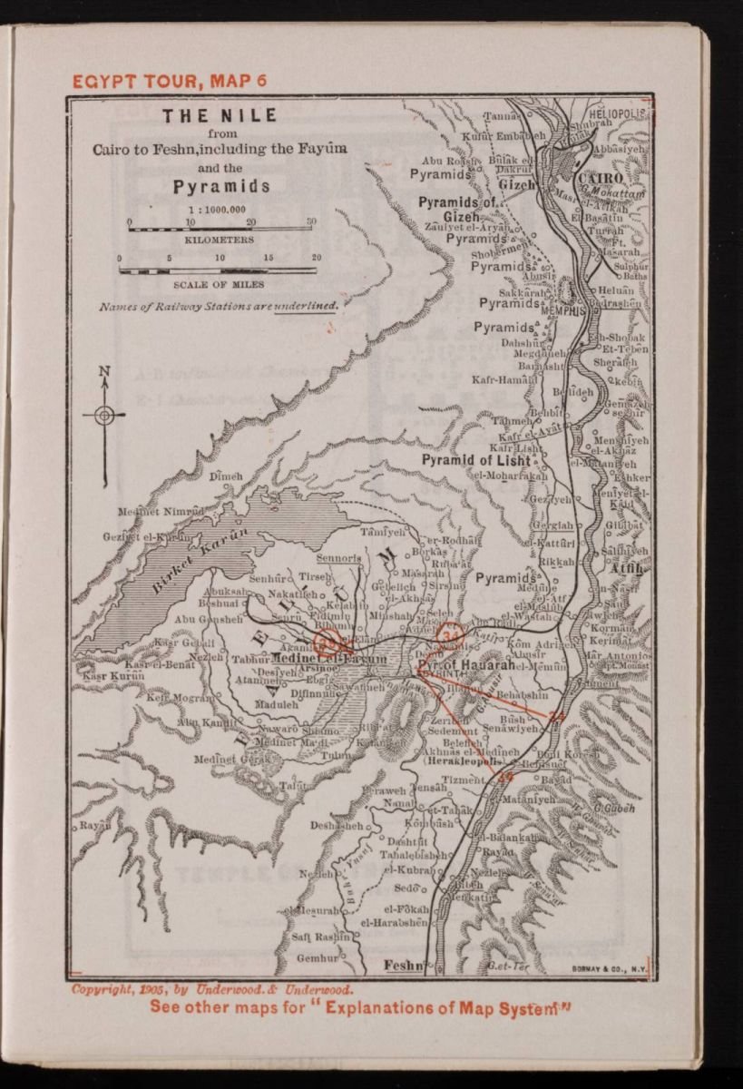
Egypt Tour, Map No. 6: The Nile from Cairo to Feshn, including the Fayum and the Pyramids
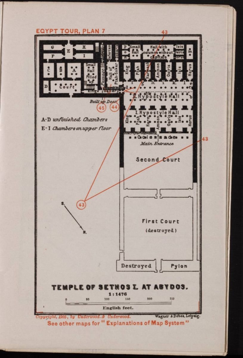
Egypt Tour, Plan 7: Temple of Sethos I. At Abydos
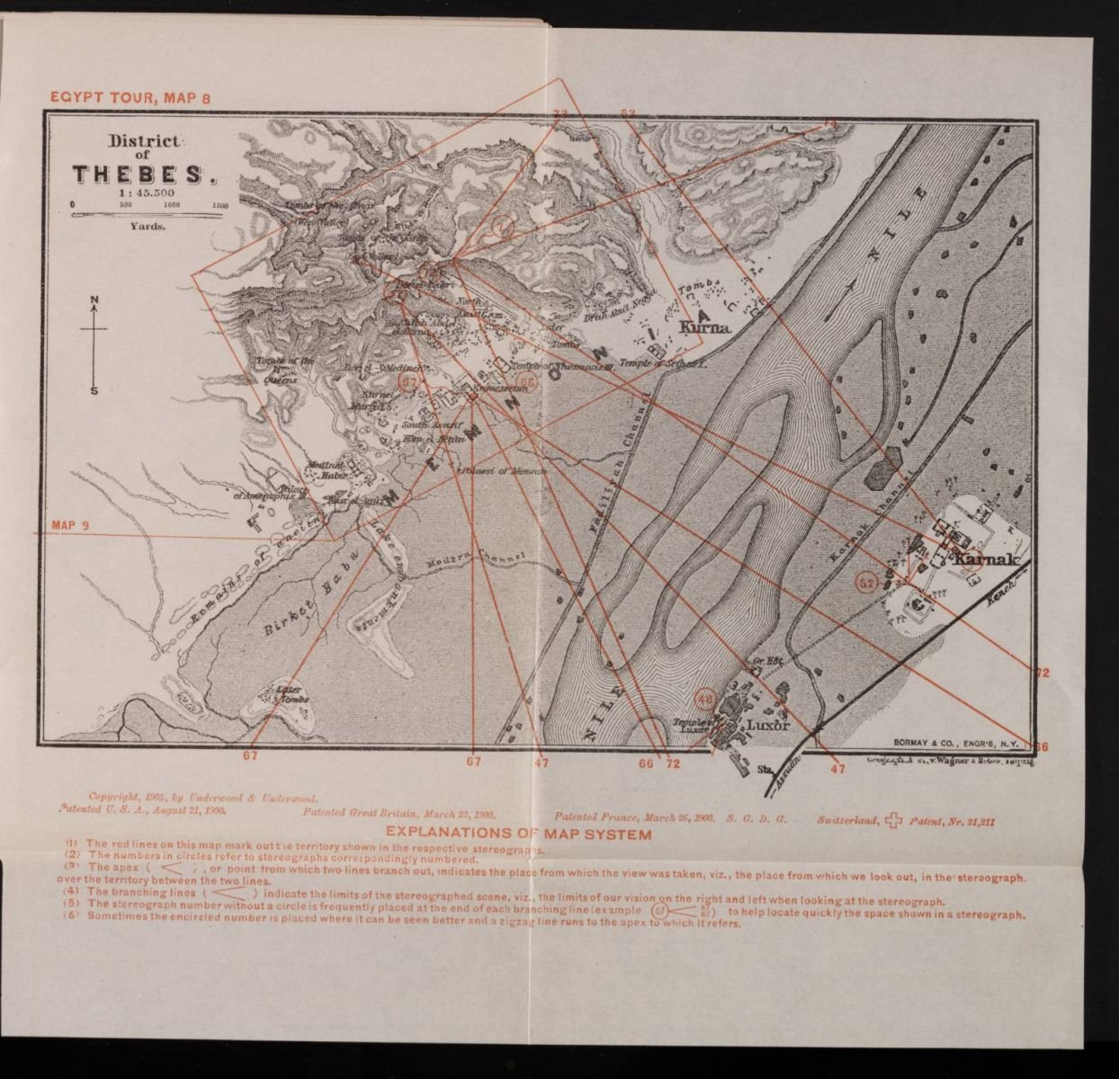
Egypt Tour, Map No. 8: District of Thebes
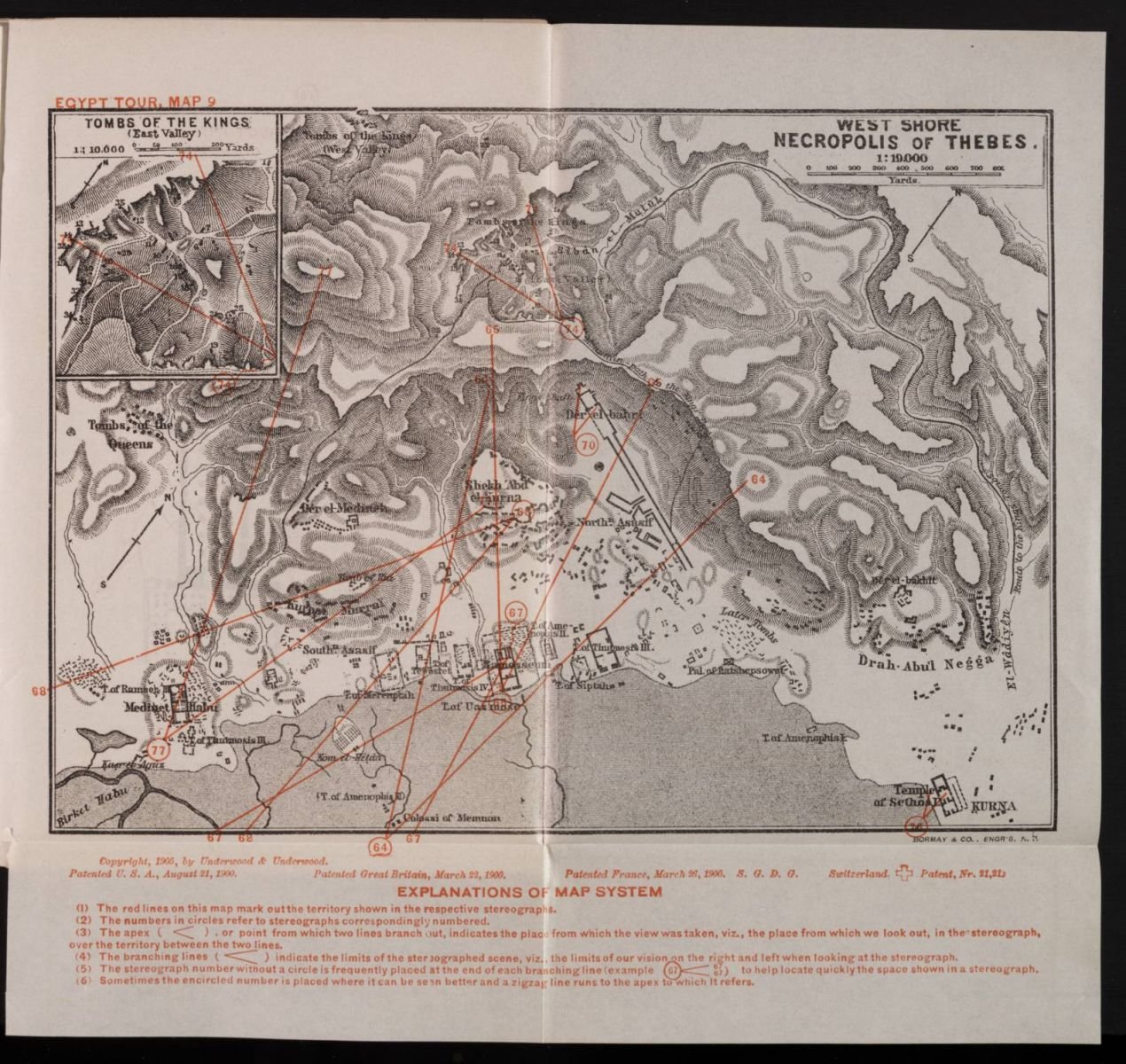
Egypt Tour, Map No. 9: West Shore, Necropolis of Thebes
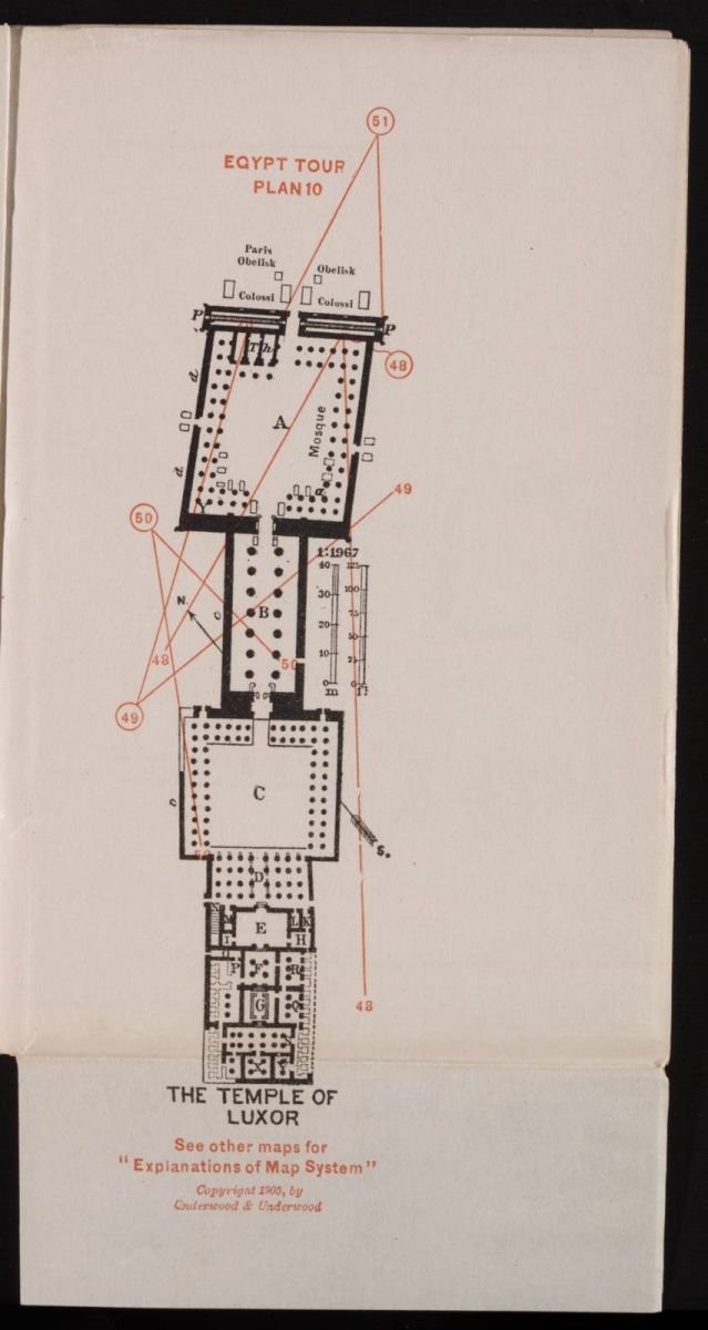
Egypt Tour, Plan 10: The Temple of Luxor
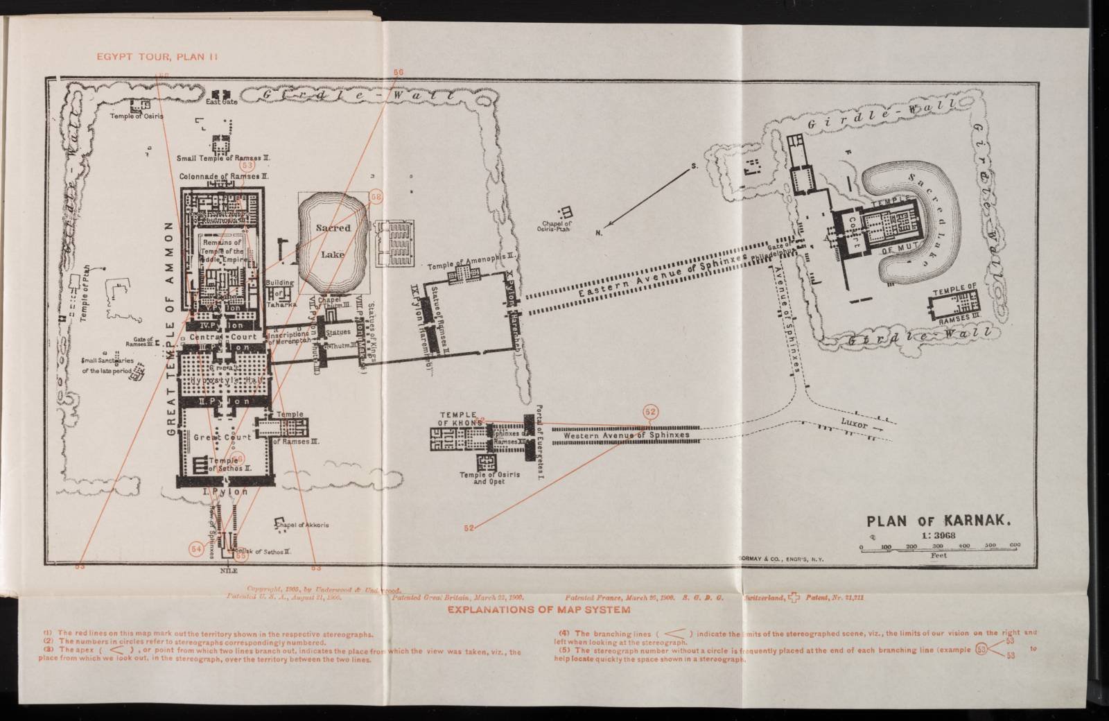
Egypt Tour, Plan 11: Plan of Karnak
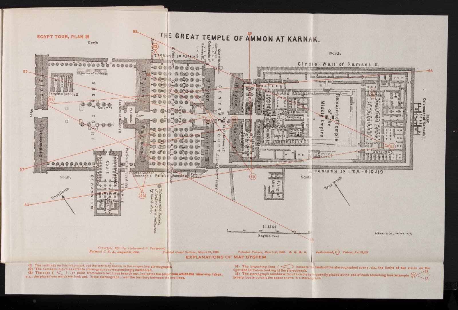
Egypt Tour, Plan 12: The Great Temple of Ammon at Karnak
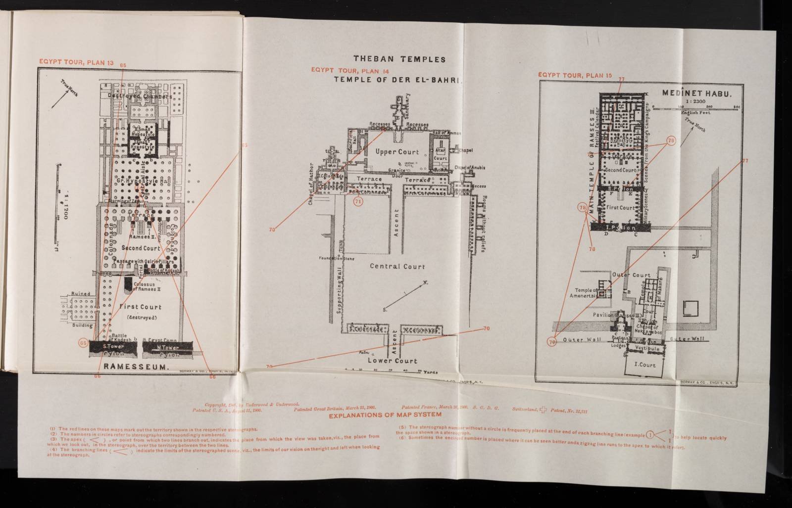
Theban Temples: Ramesseum (Plan 13), Temple of Der El-Bahri (Plan 14), Medinet Habu (Plan 15)
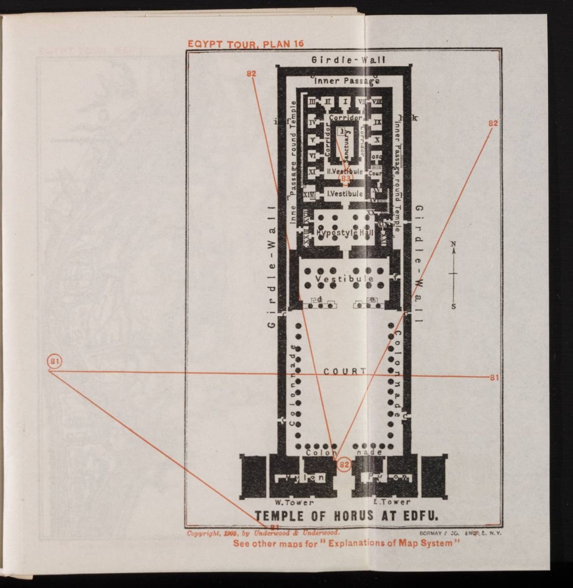
Egypt Tour, Plan 16: Temple of Horus at Edfu
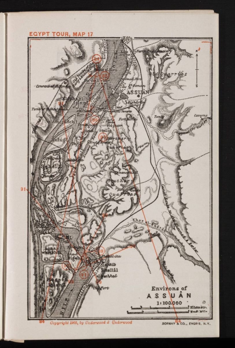
Egypt Tour, Map 17: Environs of Assuan
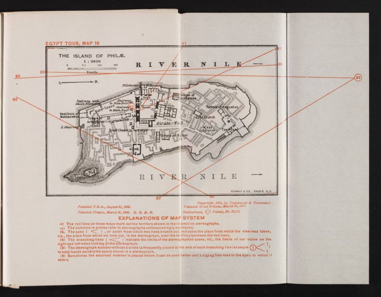
Egypt Tour, Map 18: The Island of Philae
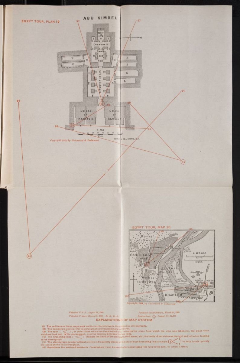
Egypt Tour, Plan 19: Abu Simbel
