Egypt Through The Stereoscope
A Journey Through The Land Of The Pharaohs
by James Henry Breasted | 1908 | 103,705 words
Examines how stereographs were used as a means of virtual travel. Focuses on James Henry Breasted's "Egypt through the Stereoscope" (1905, 1908). Provides context for resources in the Travelers in the Middle East Archive (TIMEA). Part 3 of a 4 part course called "History through the Stereoscope."...
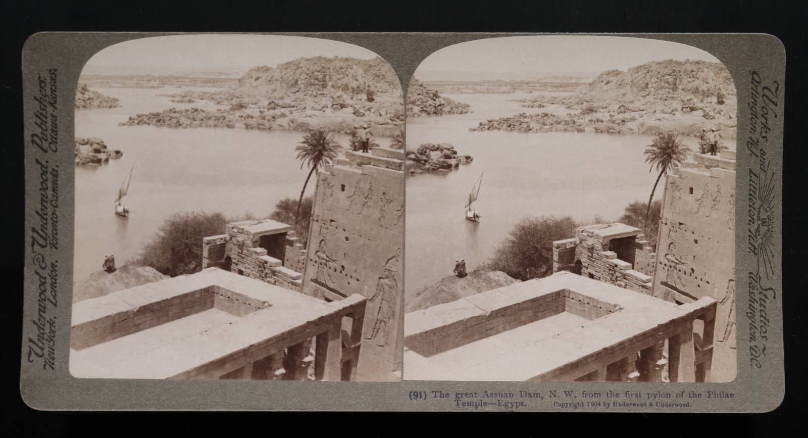
Position 91 - The Great Assuan Dam (northwest) From The First Pylon Of The Philae Temple
 That long, low wall out there means bread for the peasant, but destruction to this beautiful monument of his ancestors. Millions of cubic yards of the great life-giving river run to waste in the sea, without having benefited the land at all, beyond having rendered the service of cooling the hot air of the valley as it passed through. It is imperative to stop this annual waste of water in a practically rainless land; hence the barrage below Cairo, the dam, which we mentioned at Assiut, and this great barrier which you see yonder, the greatest dam that ever was built. The foundation stone of the vast structure, which is a mile and a quarter long, 100 feet high at the deepest part and 88 feet thick at the bottom, was laid on February 2nd, 1899, and it was completed in the autumn of 1902, a year ahead of contract time. It is entirely of granite, and is controlled by a set of sluices, 180 in number. The water can be raised 65 feet behind it, and there is thus collected all around us here a lake containing, roughly, as much as Geneva Lake in Switzerland.
This is then discharged gradually after the inundation has subsided in Lower Egypt , and it is estimated that not less than $13,000,000 will be added annually to the wealth of Egypt by the recovery of otherwise waste lands made possible by thus husbanding the water. But meantime what will become of this beautiful island? Only the tops of these buildings will project from the water, for its surface will rise to the top of that heap of earth on the left where the two men stand. When the addition to the dam, a contemplated increase in the height, is completed, the temples will be largely submerged. It is, therefore, only a matter of a comparatively short time, when this lovely spot will have become a mud-covered, desolate waste, with the ruins of its once picturesque temples, rising in shapeless heaps, and eventually disappearing. When this project was first suggested, it roused the indignation of the whole cultured world, and in the face of universal protests the government constrained the engineers to alter their plans so as not to totally submerge the temples. But the changes were not sufficient to save the buildings, as the engineers probably very well knew, but they pacified the public; and when we shall have grown accustomed to the pending destruction, the dam will be raised and the work of annihilation will be complete. Undoubtedly the work is a necessity, but it will not be a pleasant item for the future Englishman to read in his guide-book, that the great dam at this point, while insuring the payment of all interest on Egyptian bonds, resulted in the destruction of the temples on Philae.
You will notice on the Map 17 and Plan 18 that as we now stand on the left, or western, tower of the first pylon of the Isis temple, we look north-westward down the channel of the cataract, or better, down on the several channels into which it is divided at this point. The rocks on our right are the cast shore; on the left is the northern part of Bigeh, and in the channel before us, on a line with the long row of sluices in the huge dam, is the small island of Shellal. You see that the cataract does not at all resemble what we usually understand by that term, but is merely a rapid or series of rapids, caused by the outcropping of the granite at this point. The channel is thus filled with granite islands for five miles to Assuan below us. It was on one of these islands, Sehel, that we saw the inscription of the seven years' famine. Down at the right we have one corner of the temple court, the left tower of the second pylon being further to our right, while the lower building at our feet is the “birth house.” The low masonry building beyond the “birth house” is a gate built by the Emperor Hadrian. Forming our horizon beyond the dam rise the western cliffs, while behind us is the upper river, a long stretch of 217 miles to the second cataract.
We shall stop at but three points between the two cataracts, but these are such as will give us a very fair impression of the country of lower Nubia. The first stop will be at Kalabsheh, which you will find on Map 3 a short distance south of Philae. The red lines there show that we are to be looking eastward.
